The Sahara Desert experienced flooding for the first time in decades. This is what it looks like

(CNN)- Shocking pictures of the Sahara Desert show huge lakes forming in sand dunes after the first flooding in decades in one of the world’s driest and most barren places.
It rains in the Sahara, but usually only a few centimeters a year and rarely in late summer. However, for two days in September, heavy rain fell across parts of the desert in southeastern Morocco after a low pressure system moved northwest of the Sahara.
Preliminary satellite data from NASA showed that some parts of the region received about 20 centimeters of rain.
Errachidia, a desert town in southeastern Morocco, recorded nearly 7 centimeters of rain, the most in just two days last month. This is more than four times the normal rainfall for the entire month of September and equal to more than half a year for the region.
“It’s been 30 to 50 years since we’ve had this much rain in such a short period of time,” Houssain Youabeb of Morocco’s meteorological agency told the AP last week.
As rain fell on the desert area, it created a new aquatic landscape amidst palm trees and bushy vegetation.
Some of the most remarkable images are of the desert city of Merzouga, where rare floods carved new lakes in the sand dunes.
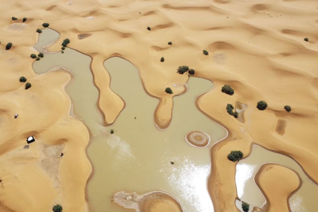
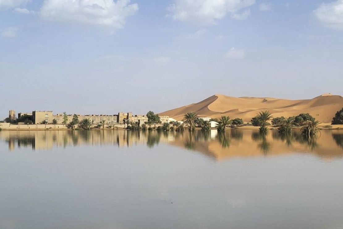
Reflections of the city’s palm trees now shine over the expanse of a new lagoon formed by steep sand dunes.
The rain also flooded lakes that are usually dry, such as Iriqi National Park, one of Morocco’s largest national parks. NASA satellite images of the area, which use false colors to better highlight floodwaters, show newly formed lakes in parts of the northwestern Sahara.


While most of the rain fell in remote, sparsely populated areas, some fell on Moroccan towns and cities, causing deadly floods last month that killed more than a dozen people.
The Sahara is the world’s largest non-polar desert, covering an area of 9.2 million square kilometres. Satellite images from September showed large swathes of the desert covered in green as storms moved further north than usual, a phenomenon that some studies have linked to human-caused climate change.
According to recent research, more extreme rainfall events can be expected in the Sahara in the future, as fossil fuel pollution is warming the planet and disrupting the water cycle.
CNN’s Brandon Miller contributed to this report.
(tagstotranslate)africa