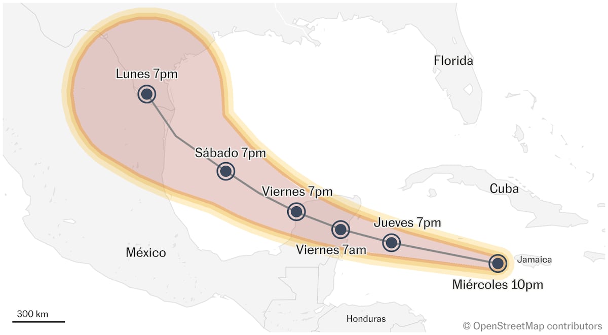
Trajectory of Hurricane ‘Beryl’ in Mexico, live | Hurricane ‘Beryl’ approaches north of Quintana Roo as a Category 2 storm

Hurricane Beryl makes landfall north of Quintana Roo as a Category 2 hurricane
storm beryl It has already hit Mexican shores. This morning, at 5:05 a.m. Central Mexico time, the storm made landfall as a Category 2 hurricane on the Saffir-Simpson scale, with maximum sustained winds of 175 kilometers per hour (km/h) and gusts of up to 220 km/h. h. north of Tulum, in Quintana Roo, according to the National Meteorological Service (SMN) of the National Water Commission.
During the next few hours, the hurricane will move west-northwest at a speed of 24 km/h over the Yucatán Peninsula. The SMN, in coordination with the United States National Hurricane Center, maintains a hurricane prevention area from Puerto Costa Maya to Cancun, Quintana Roo, including Cozumel; a monitoring area for hurricane impacts from Chetumal to Puerto Costa Maya and from Cancun to Cabo Catoche, Quintana Roo, as well as a prevention area for tropical storm impacts from Cancun, Quintana Roo to Campeche, Campeche.
Its cloud band caused torrential rains (150 to 250 millimetres (mm)) in Campeche, Quintana Roo and Yucatán this morning; intense (75 to 150 mm) in Chiapas and Tabasco; wind gusts of 175 to 215 km/h, waves 6 to 8 metres (m) high, storm surges of 3 to 5 metres and possible inundations along the coasts of Quintana Roo and Yucatán, as well as wind gusts of 120 to 140 km/h and waves 4 to 6 metres high along the coast of Campeche.
(tags to translate)mexico
